Witte Museum to Host New Exhibit Featuring Maps From the General Land Office
SAN ANTONIO, February 15, 2018 (Newswire.com) - The Witte Museum and Texas General Land Office leaders are excited to announce "Connecting Texas: 300 Years of Trails, Rails, and Roads", a new collaborative exhibition. Today Commissioner George P. Bush announced the Texas General Land Office will lend over 40 Texas maps and documents, representing 300 years, to the Witte Museum for a six-month exhibition opening February 15, 2018, through September 17, 2018.
“The General Land Office is the custodian of more 36 million documents and maps that trace the origins and distribution of public lands in Texas,” said Commissioner Bush. “Our mission is to preserve our state’s history and to provide access to these maps and documents, which date back to the 16th century. As a Texan, I’m extremely proud of our rich history, and I am honored to be able to share it with the people of Texas.”
While citizens are always invited to visit the Texas General Land Office Archives in Austin for a tour, having the maps promoted by and displayed in world-class facilities like the Witte Museum, elevates and amplifies our message. It allows thousands of school children, historians, and all Texans in the world to see this Texas history up close, and hopefully, it inspires them for the future.
George P. Bush, Commissioner
“'Connecting Texas: 300 Years of Trails, Rails, and Roads' will be an important addition to the Witte Museum’s Tricentennial focus,” said Marise McDermott, President, and CEO of the Witte Museum. “This exhibition highlights the complexity of the pathways that symbolize the many cultures that found a place in the land we now call Texas and is another way to reflect on the past 300 years of San Antonio’s history.”
"Connecting Texas: 300 Years of Trails, Rails, and Roads" will be in the Robert J. and Helen C. Kleberg South Texas Heritage Center at the Witte Museum in San Antonio, and feature maps that examine how explorers, Native Americans, armies, immigrants and early settlers moved in, around and across Texas over the last 300 years. The exhibit also celebrates the Tricentennial anniversary of San Antonio’s founding and emphasizes the integral role of the city in political, cultural and economic movement through time.
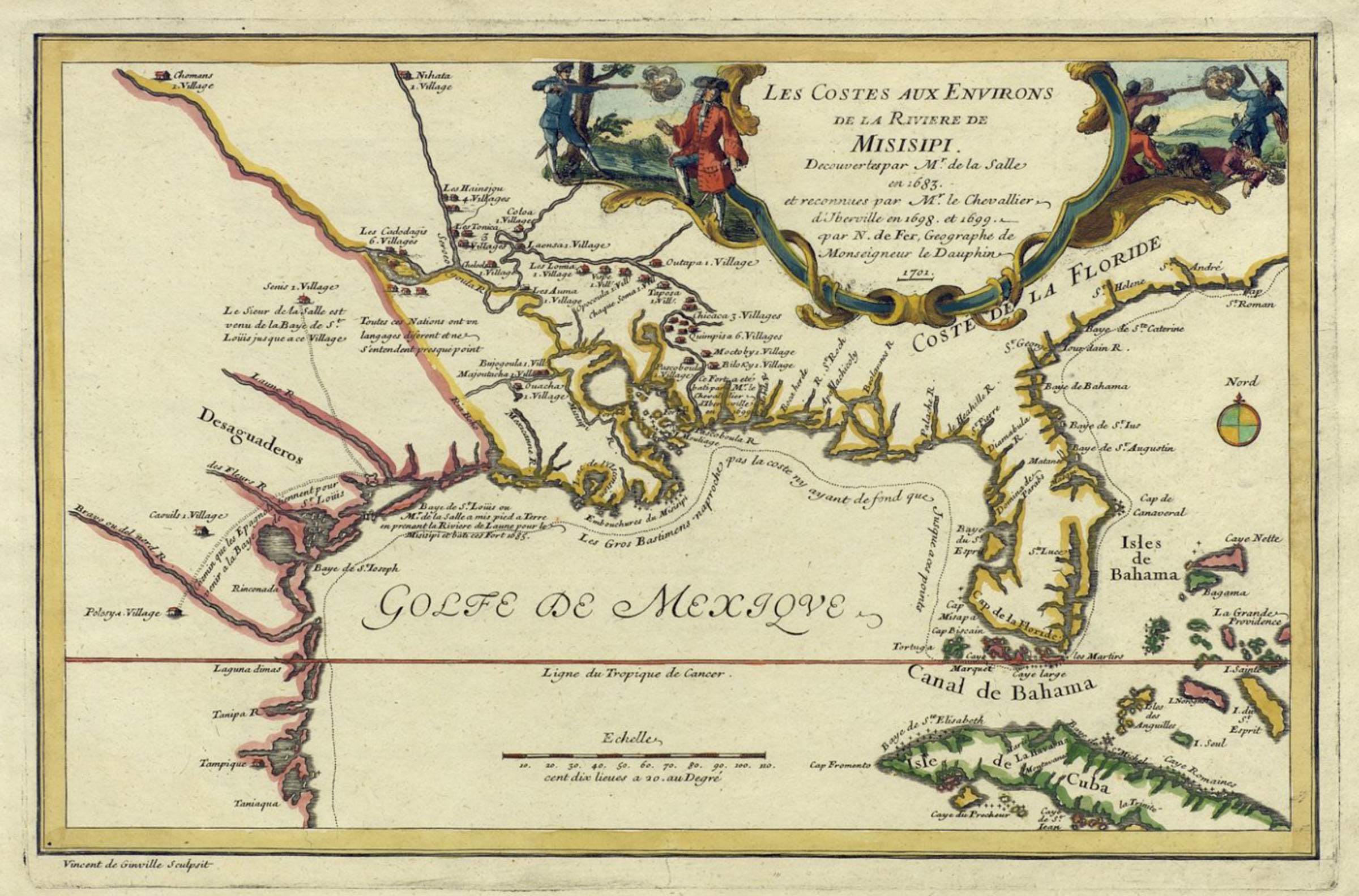
"This exhibition is a wonderful partnership among multiple institutions and private individuals," said Commissioner Bush. “'Connecting Texas: 300 Years of Trails, Rails & Roads' is our second major map exhibition collaboration with the Witte Museum, the first being Mapping Texas: From Frontier to the Lone Star State, which was seen by more than 100,000 visitors in 2016."
The works in this exhibition are mainly from the archival collection of the Texas General Land Office, and from the private map collection of Frank and Carol Holcomb of Houston, who are lending eight maps for this exhibition. Additionally, there is material on loan from private collectors Ted & Sharon Lusher of Austin, and Bill Price of Houston.
Created in 1837, the Texas General Land Office is the oldest state agency. The GLO’s Archive has collected amazing historical treasures and is considered a “hidden treasure” in state government. Commissioner Bush is committed to revealing the agency’s historical treasures and bring awareness to the public of what can be found at the General Land Office through private partnerships such as these exhibits with the Witte Museum.
“While citizens are always invited to visit the Texas General Land Office Archives in Austin for a tour, having the maps promoted by and displayed in world-class facilities like the Witte Museum, elevates and amplifies our message,” said Commissioner Bush. “It allows thousands of school children, historians, and all Texans in the world to see this Texas history up close, and hopefully it inspires them for the future.”
Some of the maps presented in this exhibit include Stephen F. Austin’s landmark 1830 map of Texas, unique plat maps that show Native American trails, one-of-a-kind manuscript military maps of the Republic and State of Texas, German immigration maps of the Texas Hill Country, hand-drawn railroad maps created to illustrate the progress of construction of railways across the state, cattle and trail maps from the 1880s, and interesting maps of Hemisfair ’68 in San Antonio, and much more.
"Connecting Texas" will be on display in the Russell Hill Rogers Texas Art Gallery and the Laura and Sam Dawson Gallery from February 17 through September 17, 2018. This exhibition is included with museum admission.
"Connecting Texas: 300 Years of Trails, Rails, and Roads" is organized by the Texas General Land Office with the Witte Museum, San Antonio. Additional support made possible by Frank and Carol Holcomb and the City of San Antonio Office and Arts and Culture.
About the Witte Museum
Founded in 1926, the Witte Museum is where Science, Nature and Culture Meet, through the lens of Texas Deep Time, and the themes of land, water, and sky. Located on the banks of the San Antonio River in Brackenridge Park, the Witte Museum is San Antonio’s premier museum promoting lifelong learning through innovative exhibitions, programs, and collections in natural history, science and South Texas heritage.
About the Texas General Land Office's Save Texas History program
Created in 2004, the Save Texas History program is a statewide initiative to rally public support and private funding for the preservation and promotion of the historic maps and documents housed in the GLO Archives, and serves as a resource for teaching and digitizing Texas history. If you would like to donate to the Save Texas History program to adopt a document or collection, assist with archival acquisitions, develop educational programs, or support digital projects, please visit SaveTexasHistory.org. Follow Save Texas History on Facebook, Twitter, and YouTube.
Source: Witte Museum