Geospatial Imagery Analytics Market to Cross USD 8 Bn by 2025: Global Market Insights, Inc.
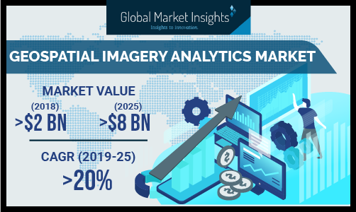
SELBYVILLE, Del., July 10, 2019 (Newswire.com) - The geospatial imagery analytics market is poised to hike from around $2 billion in 2018 to over $8 billion by 2025, according to a 2019 Global Market Insights, Inc. report. The demand for the market is increasing due to the rise in the adoption of wireless devices and location-based sensors, allowing businesses to collect location-specific data to improve their business operations. The use of analytics software provides the ability to visualize critical business objects on maps, which helps asset-intensive industries, such as transportation, energy, and the public sector, to improve efficiency and decision making.
Another factor accelerating the geospatial imagery analytics market demand is the growing popularity of cloud-based GIS solutions. GIS professionals and researchers are using cloud computing to access meaningful information on any aspect related to geospatial data. Cloud-based geospatial imagery analytics solutions are delivered as Software-as-a-Service (SaaS)-based platform and help in improving collaboration between various users who share and update the mapping data.
Request a sample of this research report @ https://www.gminsights.com/request-sample/detail/2841
The image-based analytics segment in the geospatial imagery analytics market is expected to hold a share of over 75% by 2025 due to the extensive use of various geospatial image capturing platforms such as drones, surveillance cameras, and satellites. GIS professionals and geoscientists are making use of geospatial imagery analytics tools to analyze raw data in the form of images captured by aerial imaging platforms and convert them into useful maps for further analysis. The data collected from satellite sensors or airborne cameras in the image format serves as a valuable source of information to support geospatial assessment and modeling.
The cloud-based deployment model is projected to grow at a CAGR of over 25% in the geospatial imagery analytics market from 2019 to 2025. With cloud-based geospatial imagery analytics solutions, organizations need not focus on keeping their infrastructure up-to-date, making it easier for them to manage and map records on the cloud. The companies present in the market are offering cloud GIS services on a pay-per-use pricing model to help customers who don’t have required resources and skills to manage GIS implementations in-house.
The Unmanned Aerial Vehicles (UAVs) segment in the geospatial imagery analytics market is expected to witness the fastest growth rate from 2019 to 2025 due to the widespread adoption of these aerial imaging platforms to cater to the demands of businesses in various verticals such as agriculture, mining, construction, and defense. Reduction in the cost of hardware needed to fabricate UAVs and advancement in sensor technologies are making UAVs more popular for the extraction of spatial data. Drone manufacturing companies are making use of AI to improve their drone’s capabilities, enabling them to map areas and provide analytical feedback in real-time.
Browse key industry insights spread across 274 pages with 305 market data tables & 31 figures & charts from the report, “Geospatial Imagery Analytics Market Size By Analytics Type (Image-based Analytics, Video-based Analytics), By Deployment Model (On-premise, Cloud), By Collection Medium (Geographic Information System (GIS), Satellite Imagery, UAV), By Application (Agriculture, Construction, Mining, Oil & Gas, Telecom, Government, Transportation & Logistics) Industry Analysis Report, Regional Outlook (U.S., Canada, UK, Germany, France, Italy, Spain, Netherlands, China, Japan, Australia & New Zealand (ANZ), South Korea, India, Southeast Asia, Brazil, Mexico, Argentina, UAE, South Africa, Saudi Arabia, Israel), Growth Potential, Competitive Market Share & Forecast, 2019 - 2025” in detail along with the table of contents:
https://www.gminsights.com/industry-analysis/geospatial-imagery-analytics-market
The agricultural sector is expected to grow at a CAGR of over 25% over the forecast timeline. Geospatial technologies are playing an important role in the agriculture industry by improving farm production, reducing costs, and enabling farmers to manage land resources in a proper manner. By mapping the geographic features of farms, farmers and scientists can develop more effective farming techniques to increase their crop yield, erosion detection, and determine the best crops to plant. The large-scale adoption of drones for precision farming will also spur the geospatial imagery analytics market growth.
The Asia Pacific geospatial imagery analytics market is expected to show excellent growth rate between 2019 and 2025, growing at a CAGR of over 25%. In the region, various aerial imaging platforms, such as drones and surveillance cameras, are widely used in agriculture, construction, marine, and defense to gather spatial information, which can be used by GIS professionals to support their decision-making process. Also, favorable government initiatives for the development of the space industry will also result in the uptake of satellite navigation systems to capture high-resolution geospatial imagery, which can be analyzed to identify patterns to support various industrial applications.
Make an Inquiry for purchasing this report @ https://www.gminsights.com/inquiry-before-buying/2841
Browse Related Reports:
Geographic Information System (GIS) Market Size By Component (Hardware [GIS Collectors, GNSS Antenna, Total Station, LiDAR], Software [Desktop GIS, Web GIS, Mobile GIS], Service [Training & Consulting, Integration & Maintenance, Managed Service]), By Application (Mapping, Surveying, Location-based Service, Telematics and Navigation), By End-Use (Agriculture, Construction, Mining, Oil & Gas, Telecommunication, Government, Transportation and Logistics), Industry Analysis Report, Regional Outlook (U.S., Canada, UK, Germany, France, Italy, Spain, Netherlands, China, Japan, Australia, South Korea, India, Southeast Asia, Brazil, Mexico, Argentina, South Africa, UAE, Saudi Arabia, Israel), Growth Potential, Competitive Market Share & Forecast, 2018 - 2024
https://www.gminsights.com/industry-analysis/geographic-information-system-gis-market
LiDAR Market Size By Product (Airborne [Topographic, Bathymetric], UAV, Terrestrial [Mobile, Static]), By Type (Mechanical, Solid-state), By Application (Corridor Mapping [Roadways, Railways, Bridges & Tunnels], Engineering, Environment, Driverless Cars, Exploration & Meteorology, Cartography), Industry Analysis Report, Regional Outlook (U.S., Canada, Germany, UK, France, Italy, Spain, Australia, China, India, Japan, South Korea, Brazil, Mexico, GCC, South Africa), Application Development, Competitive Landscape & Forecast, 2019 - 2025
https://www.gminsights.com/industry-analysis/lidar-light-detection-and-ranging-market
About Global Market Insights
Global Market Insights, Inc., headquartered in Delaware, U.S., is a global market research and consulting service provider; offering syndicated and custom research reports along with growth consulting services. Our business intelligence and industry research reports offer clients with penetrative insights and actionable market data specially designed and presented to aid strategic decision making. These exhaustive reports are designed via a proprietary research methodology and are available for key industries such as chemicals, advanced materials, technology, renewable energy and biotechnology.
Contact Us:
Arun Hegde
Corporate Sales, USA
Global Market Insights, Inc.
Phone: 1-302-846-7766
Toll Free: 1-888-689-0688
Email: sales@gminsights.com
Web: https://www.gminsights.com
Source: Global Market Insights, Inc.