Australia Bush Fires in Sydney Visualized Using WhereOS Satellite Data Application
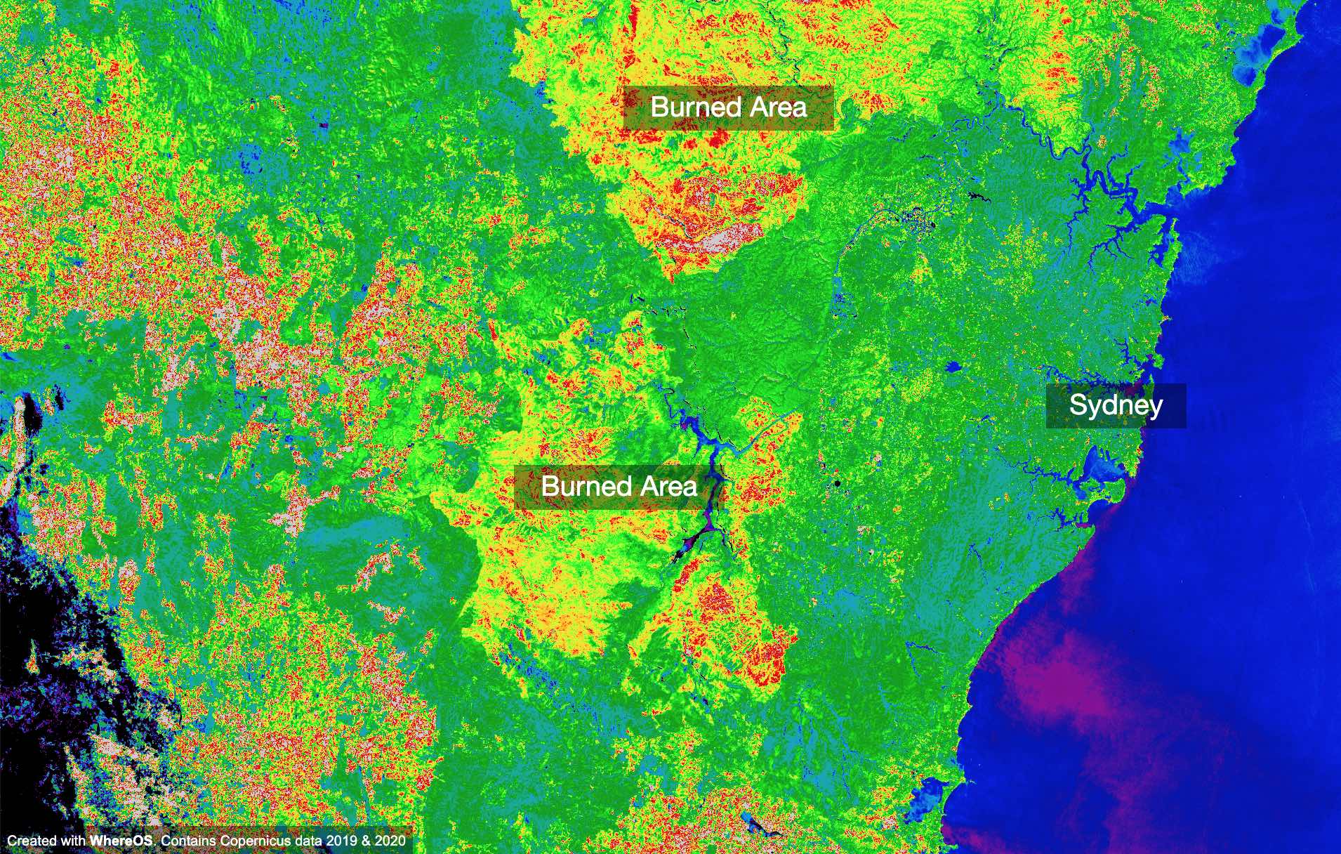
SAN FRANCISCO, January 15, 2020 (Newswire.com) - Australia bush fires so far: up to 200,000 square kilometers burned, tens of lives and thousands of homes lost, up to 1 billion animals impacted. For Australia's 2019 and 2020 bush fires, WhereOS has created a visualization that shows the fires and destruction in the Sydney area in Australia. See the impacts of the bush fires using the WhereOS interactive visualization.
WhereOS launched today a satellite data analysis application that helps companies and organizations to understand climate change and environmental impacts - among others - by processing satellite data and creating interactive visualizations and applications. Besides satellite data, WhereOS can be used for geospatial data analytics and innovation - helping companies and organizations to rapidly develop new innovative applications based on data.
About WhereOS
WhereOS facilitates faster innovation for data-driven businesses and organizations. With an Ecosystem-as-a-Service model, WhereOS can provide a holistic solution for companies who want to get more value out of their data and turn data into valuable insights and assets.
Press contact:
Mr. Jussi-Pekka Partanen
+358 50 486 9257
support@eaglepeaks.com
Source: WhereOS