Astraea Launches EarthAI Notebook
CHARLOTTESVILLE, Va., December 20, 2019 (Newswire.com) - Astraea, Inc. announced today its release of EarthAI Notebook, a new tool for analyzing geospatial data. EarthAI Notebook is a fully hosted and managed JupyterLab Notebook designed specifically to analyze raster data at scale, allowing users to unlock insight from geospatial imagery at an unprecedented scale.
"Imagery data is currently too large, costly, and complex to run any sort of efficient analysis on," says Brendan Richardson, CEO at Astraea. "We believe that EarthAI Notebook will enable scientists, developers, and organizations alike to extract information from the terabytes of Earth-observation data being collected each day."
Features and benefits of EarthAI Notebook include:
- Cloud-Native - Our hosted solution lets a user to seamlessly scale analysis from their laptop to the cloud.
- Data Included - Access over 8+ Petabytes of Earth-observing satellite imagery through our integrated API connection to Astraea's Earth OnDemand platform.
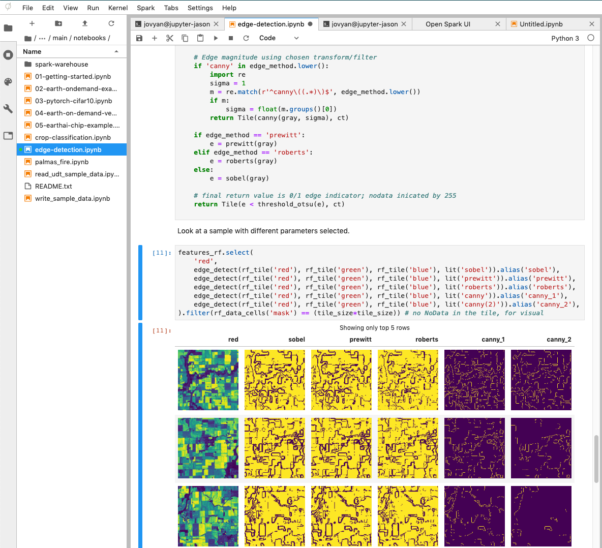
- Imagery Optimized - Provides users the tools required to analyze raster data using Python, SQL, or Scala in a tabular DataFrame, powered by Apache Spark.
- Commercial Friendly Licensing - All tiers of EarthAI are intended for commercial applications.
EarthAI Notebook will be available starting Thursday, Dec. 19, for FREE through a 30-day trial with no credit card required. For more information on EarthAI Notebook, visit www.astraea.earth.
About Astraea
Astraea is an early-stage startup located in Charlottesville, Virginia. We enable individuals and organizations to unlock insight from geospatial data at global scale. Our cloud-native platform provides the tools and infrastructure required to build production-level analytics on satellite and drone imagery.
Media Contact
Shannon Tevendale
Marketing & Communications Manager
shannon@astraea.io
434-202-5406
Source: Astraea, Inc.