Agribotix Delivers Critical Corn Count Information Using Artificial Intelligence
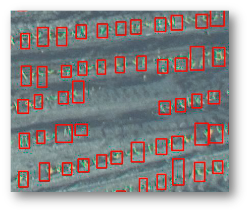
Boulder, CO, May 16, 2017 (Newswire.com) - Today, agricultural-drone analytics service company Agribotix, announced the wider beta availability of its first plant count product. Designed for corn growers, the product uses artificial intelligence (AI) to identify and count corn plants in drone-collected imagery while ignoring other items in the images. By rapidly identifying areas where emergence is below expectations, growers can use the results to take actions which will help maximize their yields.
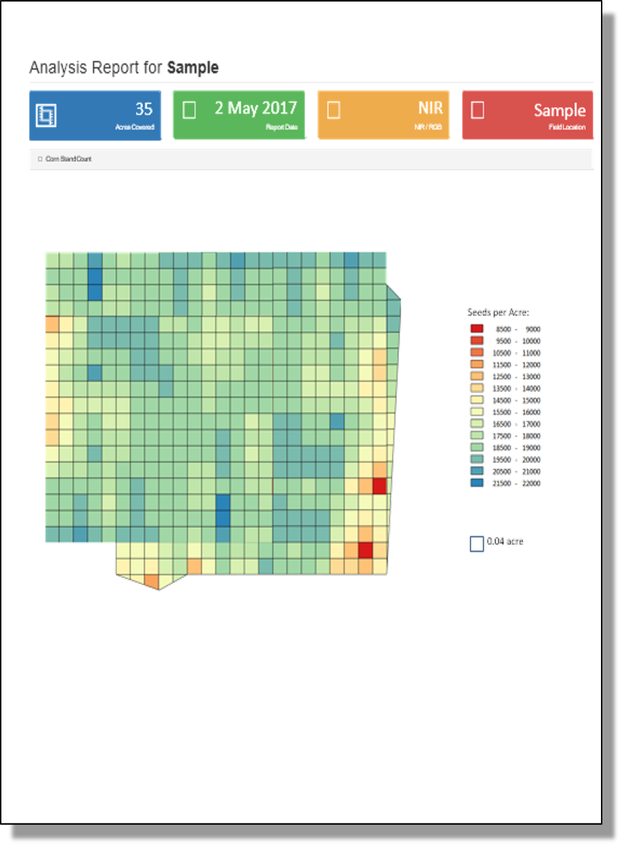
Within FarmLens™, Agribotix’s award-winning data analysis and reporting solution, the plant count report presents the results as a color-coded map of the field showing emergence in each area as well as actual count ranges. “Our customers have been telling us that they want an alternative to hand counting a small section and extrapolating to the entire field,” said Tom McKinnon, CTO of Agribotix. “Our color-coded results make it easy to find areas that have emergence issues. We are starting with corn and will use the capabilities developed there for other plants as well for AI-driven solutions like weed identification.”
The amount of technology behind these easy-to-use reports is impressive. Using the latest AI techniques, the Agribotix service analyzes virtually every inch of the field looking for new corn plants while ignoring similar-looking items like weeds or crop residue from prior years.
Corn plant count is currently available in a controlled beta to a limited number of participants. During the beta phase, the count results will be delivered free of charge. To apply to participate in the beta, please send an email with your FarmLens user id to info@agribotix.com.
About Agribotix
Founded in Boulder, Colorado, in 2013, Agribotix LLC delivers agricultural intelligence to increase yields and profits using drone-enabled technologies. All Agribotix solutions include FarmLens,™ a leading cloud-based data analysis and reporting solution for people using drones in agriculture. Outputs include agricultural intelligence maps for in-season fertilization, georeferenced reports that can be used to identify resistant weed patches and estimate coverage, stand density analysis, and specialized reporting that supports precision agriculture programs. The FarmLens solution is available separately and in complete bundles.
For more information, visit www.agribotix.com or call (720) 295-3625.
Agribotix, FarmLens, and Agrion are trademarks of Agribotix, LLC.
Source: Agribotix
Related Media